From Pine Forests to Desert Peaks: The Changing Landscapes of the Rongai Route
When people start looking into Kilimanjaro routes, they usually focus on how hard each one is and the chances of reaching the summit. That’s helpful, but it leaves out an important question: what will you actually see along the way? The Rongai Route, the only path up the mountain from the north, gives you a landscape experience that stands apart from all the others. It’s not just a small difference. The scenery, colors, air, and wildlife all change in unique ways at every stage.
Why the Rongai Route Looks Different From Every Other Kilimanjaro Path
Kilimanjaro is almost right on the equator. Its southern slopes get a lot of rain from the Indian Ocean, but the northern side, where the Rongai Route starts, is much drier because it sits in a rain shadow. This one difference changes everything: the forest is less dense, the soil is drier, different plants and animals live here, and even the morning light looks different.
If you take the Machame or Lemosho routes, you begin in thick, wet rainforest with a closed canopy and muddy trails. The Rongai Route is different right from the start. The air is dry, the forest opens up quickly, and you get wide views much sooner. As you climb, the changes between each zone feel more sudden, more striking, and often more enjoyable to experience.
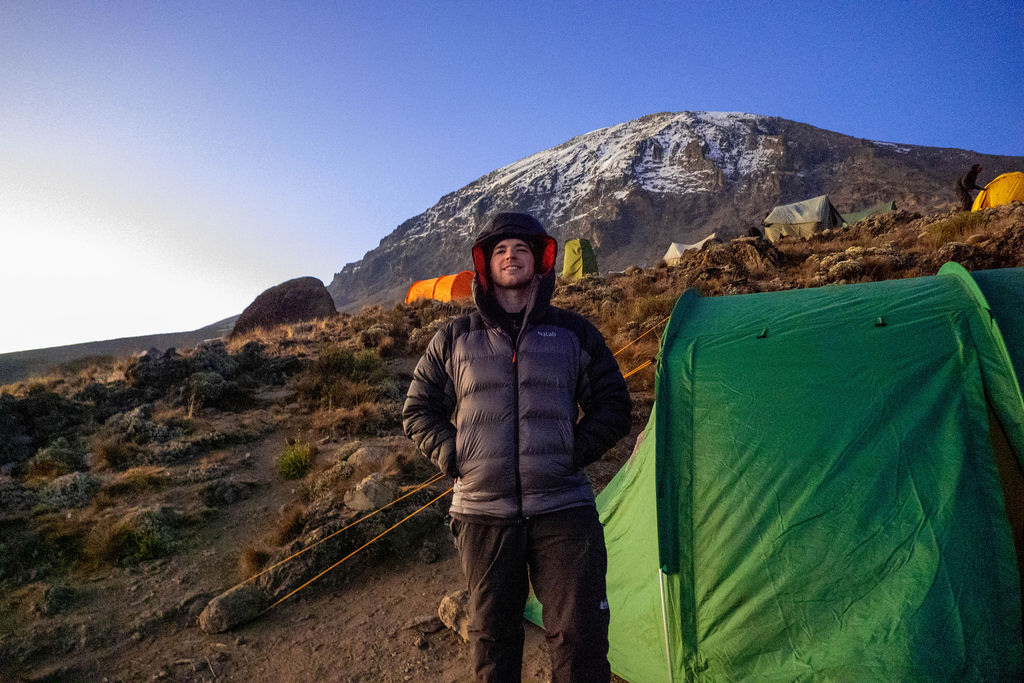
Zone 1: The Pine and Podocarpus Forest (1,950m to 2,600m)
The Rongai Gate is about 1,950 meters up on the northeast side of Kilimanjaro, close to the Kenyan border. The trail starts in farmland and coffee fields before you enter the lower forest. In just half an hour, it feels like you’ve stepped into a completely new world.
What You’ll See and Hear
This forest is filled with East African yellow wood (Podocarpus falcatus), African pencil cedar, and some pines. The canopy here is lighter and lets in more sunlight than the thick forest on the southern side. Early morning light shines through the trees in ways that trekkers on the southern routes rarely see at the start of their climb.
This is one of the few places on Kilimanjaro where you might see large wildlife early in your trek. Black and white colobus monkeys move through the tree tops, and blue monkeys are often seen on the ground. In the open grasslands below the forest, our guides have spotted elephants, buffalo, and antelope more than once. On clear mornings, you can also see Kenya’s Amboseli plains stretching out to the north.
Walking here is easy and steady, which is just what you want on your first day. The trail isn’t steep, the ground is solid, and you reach Simba Camp (about 2,650 meters) feeling ready for more instead of worn out.
Zone 2: Moorland and Giant Heather (2,600m to 3,500m)
Once you’re above the treeline, the Rongai Route moves into Kilimanjaro’s heath and moorland zone. But on the eastern side, this area looks and feels quite different from what you find on the Machame or Lemosho routes.
The Eastern Moorland Is Drier Than You Expect
On the wetter western and southern routes, this area is boggy, with thick, bright green moss hanging from tree heather. The Rongai moorland is more open and dry. Giant heather (Erica arborea) is still common, but the ground is firmer, the views are broader, and the clear air makes everything seem closer than it really is.
You’ll see tussock grasses, everlasting flowers (Helichrysum), and, as you climb higher, the first Kilimanjaro groundsels (Senecio kilimanjari). These ancient-looking plants, with tall stalks and rosette tops, are a signature of the upper mountain. On the Rongai Route, you spot them earlier and in more open areas than on other routes.
The camps at Second Cave and Kikelewa Cave are in this area. On a clear day, you can see far across the Kenyan plains from here. People often call Kilimanjaro an island rising from the savannah, and when you stand in the Rongai moorland, you really see why.
Zone 3: Alpine Desert and Mawenzi Tarn (3,500m to 4,300m)
Here, the Rongai Route showcases what makes it special: its approach to Mawenzi Peak. As the plants thin out and more volcanic rock appears underfoot, Mawenzi’s sharp towers start to fill the eastern skyline.
The Most Dramatic Campsite on the Mountain
Mawenzi Tarn is about 4,315 meters high, set in a natural bowl below the east face of Mawenzi. Many say it’s the most stunning campsite on Kilimanjaro. The small glacial lake here reflects Mawenzi’s rocky towers at sunrise in a way that photos just can’t match.
There’s hardly any vegetation left here. You’ll find cushion plants in the rocks, a few Senecio groundsels, and some tough grasses growing through the volcanic scree. It’s completely silent. Most groups spend a day here to acclimatize, hiking up to Mawenzi Ridge for some of the best close-up views of Kilimanjaro’s second peak.
Zone 4: The Saddle, Africa’s Largest High-Altitude Desert (4,300m to 4,750m)
Between Mawenzi in the east and Kibo in the west lies the Saddle, a high-altitude desert plateau about 3,600 hectares wide. It’s truly one of the most unusual landscapes in Africa.
The Saddle is between 4,300 and 4,750 meters high. There’s almost no plant life. The ground is loose volcanic scree, grey-brown and moonlike, with wind-shaped ridges and some frost-heaved boulders. The sky feels huge above you. On the Rongai Route, you cross the Saddle the day before summit night, which takes four to five hours of steady, open walking.
This part of the route is unlike anything else on Kilimanjaro. After walking through forest, moorland, and alpine desert, you find yourself on a plateau that looks more like the moon than Africa. The high altitude makes you focus on every breath. The wind is always cold. At the far end, Kibo’s volcanic wall rises up, showing the mountain’s ancient, rugged side.
Zone 5: The Arctic Summit Zone (4,750m to 5,895m)
The last stretch from Kibo Hut to Uhuru Peak starts at midnight and is done in darkness for several hours. You can’t see much, but you feel the loose scree turning into harder volcanic rock, the temperature dropping to minus ten or lower, and the thin air slowing everyone down, even experienced trekkers.
At Gilman’s Point (5,685 meters) on the crater rim, the sky starts to brighten. On a clear morning, the view here is one of the best on the mountain. To the south, you see the shrinking but still impressive glaciers of Kilimanjaro’s ice cap. To the north, there’s the moonlike Saddle, Mawenzi, and the plains of Kenya beyond. The path to Uhuru Peak follows the crater rim past the Rebmann and remnants of the Furtwangler Glacier, reminders that this ice field is disappearing.
The Descent: A Different World Entirely
The Rongai Route goes down the mountain using the Marangu Route on the south side. This means you get a true cross-mountain experience: you climb up through the dry northern side and come down through the thick, green rainforest of the south.
The difference is striking. As you descend through Horombo and down to Marangu Gate, you walk through a rainforest that feels completely different from the pine and podocarpus forest at the start. Moss covers every branch, the canopy is thick, and the air is warm and humid. Most people notice the change right away. That moment of stepping from one world into another is a special part of the Rongai Route.
Planning a trip with KiliDestination
If you’re thinking about trekking Kilimanjaro and want a route where the scenery is a big part of the experience, our team has guided groups through every part of this mountain for years. We know the best places to stop, what to look for, and how to read the mountain at each stage. Check out our Kilimanjaro trekking packages or contact us for a personalized plan. There’s no pressure, just honest advice from locals.
Frequently Asked Questions
Q. Is the Rongai Route actually scenic, or is it considered boring compared to other routes?
The idea that ‘Rongai is less scenic’ is outdated and too simple. This route has its own unique features: dry forests, open moorland with wide views of Kenya, the dramatic Mawenzi Tarn, the moon-like Saddle, and a lush southern descent. Many experienced Kilimanjaro climbers find it more rewarding because it’s so different from what they expect.
Q. How many climate zones does the Rongai Route pass through?
Five distinct zones: montane forest, heath and moorland, alpine desert, high altitude tundra (the Saddle), and the arctic summit zone. The descent via Marangu adds a sixth, the lush southern rainforest, creating a genuinely cross-mountain experience.
Q. Can you see wildlife on the Rongai Route?
Yes, more readily than on most other routes. The lower northern slopes are adjacent to wilderness areas, and sightings of colobus monkeys, blue monkeys, buffalo, elephant, and antelope have been recorded at the forest and moorland margins. The open northern plains offer visibility toward Amboseli that other routes simply don’t.
